| Geography of Sardinia | 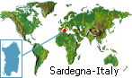 |
| Surface: |
24.090 Kmq |
| Main town: |
Cagliari |
| Main towns of province: |
Nuoro, Oristano, Sassari |
| Main mountains: |
Gennargentu (1834 m.) |
| Main rivers: |
Tirso (135 Km.) e Flumendosa (127 Km.) |
| Main lakes: |
Lake of Coghinas, Pond of Cabras,
Lake Omodeo |
| Main islands: |
Sant'Antioco (109 Kmq),
San Pietro (51,3 Kmq), Asinara (50,9 Kmq),
La Maddalena (20,1 Kmq) |

|
Sardinia is the second greatest island of the Mediterranean: it measures
24.090 kmq, it is situated between 38° 51' 52 '' and 41° 15' 42 '' of
latitude North and 8° 8' and 9° 50' of East longitude.
The coasts of Sardinia (1.849 Km long) are generally high and rocky,
rectilinear for kilometres, they are often articulated in promontories,
with ample and deep bays and inlets surrounded by smaller isles.
The Island, being an ancient territory with rocks that go back to the
Ancient Palaeozoic (300.000 years ago), doesn't possess any high mountain
because of its long erosion processes.
The granite, schist, tranchite, basalt (called "jars" or "gollei"),
sandstone, dolomie-limestones (called "tonneri" or "heels") rocky highlands
predominate on a height between 300 and 1.000 meters.
|
The Gennargentu
detaches among the high mountainous, in the center of the Island, with its
higher peak (1,834 m.), the Mount Limbara (1,362 m.) in the North and the
Rasu Mount, culminating part of the so-called "Marghine chain", that runs
crosswise for 40 Km towards North.
|
The climate is generally mild, influenced by Atlantic, African and Artic air
masses. The weather is clear: in the arc of the year approximately 300 days
are sunny and the others rainy, with a great concentration of rainfall in
winter and autumn and some unexpected heavy showers in spring.
|
The Island is ventilated. The mistral dominates - a Norh-West wind - fresh
and strong in winter, in summer mitigates the climate making the air dry and
unbreathable.
The Sirocco, which is exposed the southern coast, is less frequent as well
as the Levant winds and those of Northeast, which blow along the oriental
coast.
|
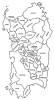 The Geographic regions of Sardinia The Geographic regions of Sardinia
|
|
 Send this page to a friend
;) The Geographic regions of Sardinia
The Geographic regions of Sardinia